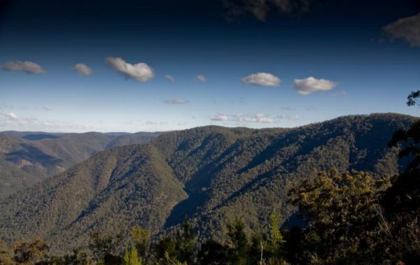
Raspberry Lookout Gibraltar Range National Park Rest Area
Location Map
Raspberry Lookout Gibraltar Range National Park Rest Area location map
Address
Gwydir Highway, Gibraltar Range National Park, 2370, New South Wales
Sat Nav Coordinate
-29.555633, 152.2516
Road Access
Asphalt Road Surface
Parking Area
Predominantly Asphalt Surface
Drive through site
Not Suitable for Caravans
Big Rigs
Unknown - if there is room to maneuver a big rig successfully
Power Available
No onsite mains power available
Toilets
Yes - At least one public toilet block available
Dump Point
No black water dump point
Rubbish Bins
No rubbish bins onsite - So PLEASE Take your rubbish with you when you leave
Drinking Water
No drinking water onsite - Bring your own fresh water with you
Shade
Yes - Quite a few Shady Spots to select from
Picnic Tables
Yes - At least one Picnic Table located here
Fixed Fire places
Yes - At least one fixed fireplace onsite - Remember to bring your own supply of firewood
Fixed BBQ's
Yes - At least one BBQ facility is available
Pet Friendly
No Dogs Permitted at any time
Childrens Playground
No playground infrastructure onsite
Short Walks
Yes - Room to stretch your legs on short walks
Fishing
No fishing spots within easy walking distance
TV Reception
Unknown if you can get a TV signal here
Mobile Phone Reception
Unknown if you can get a mobile signal here
Internet Access
Unknown if you can recieve a mobile phone Internet signal here
Unique Pageviews
3,974
Facilities Available
 ,
,  ,
, 
Camping Info