Stoney Creek Rest Area
Location Map
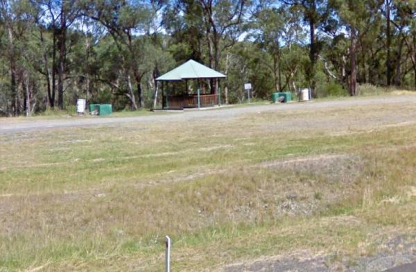
360 view - Entrance to the Stoney Creek Rest Area
Stoney Creek Rest Area location map
Address
Oxley Highway, Walcha, 2354, New South Wales
Sat Nav Coordinate
-31.07653, 151.777683
Entrance side
Vehicles travelling Westbound
Suitable for
Shared - Cars and Trucks
Road Access
Asphalt Road Surface
Parking Area
Gravel Surfaced Area
Drive through site
Yes - Some Drive through sites available
Big Rigs
Yes - there is room to maneuver
Power Available
No onsite mains power available
Toilets
No public toilets at this location
Dump Point
No black water dump point
Rubbish Bins
Yes - At least one rubbish bin located here
Drinking Water
Creek or River Water is within walking distance
Shade
There is limited shade available at this location
Picnic Tables
Yes - At least one Picnic Table located here
Fixed Fire places
Yes - At least one fixed fireplace onsite - Remember to bring your own supply of firewood
Fixed BBQ's
Yes - At least one BBQ facility is available
Pet Friendly
Yes - Dogs are Permitted Conditions Apply
Childrens Playground
No playground infrastructure onsite
Short Walks
Yes - Room to stretch your legs on short walks
Fishing
Yes - Some Fishing spots within walking distance
TV Reception
Unknown if you can get a TV signal here
Mobile Phone Reception
Unknown if you can get a mobile signal here
Internet Access
Unknown if you can recieve a mobile phone Internet signal here
Unique Pageviews
3,235
Facilities Available
 ,
,  ,
,  ,
, 
Camping Info