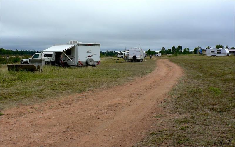
Macrossan Park Rest Area
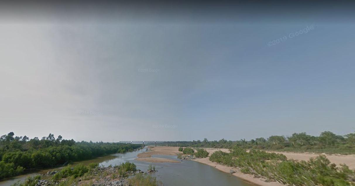
From the Macrossan Park Rest Area you can drop the kayak in and paddle down and have a look at the twin railway bridges. Perhaps you would prefer to sit on the bank of the Burdekin River, and kill some time fishing. Don't forget to take your camera with you.
Location Map
360 view - Entrance to the Macrossan Park Rest Area
Macrossan Park Rest Area location map
Address
Flinders Highway, Dotswood, 4820, Queensland
Sat Nav Coordinate
-20.002886, 146.439347
Entrance side
Vehicles travelling Westbound
Suitable for
Caravans and Motorhomes
Road Access
Asphalt Road Surface
Parking Area
Gravel Surfaced Area
Elevation above Sea Level
231.6 meters
Drive through site
Yes - Some Drive through sites available
Big Rigs
Yes - there is room to maneuver
Power Available
Yes - Mains Power is available here
Toilets
Yes - At least one public toilet block available
Dump Point
No black water dump point
Rubbish Bins
Yes - At least one rubbish bin located here
Drinking Water
Creek or River Water is within walking distance
Shade
No shade to be had anywhere
Picnic Tables
Yes - At least one Picnic Table located here
Fixed Fire places
Yes - At least one fixed fireplace onsite - Remember to bring your own supply of firewood
Fixed BBQ's
Yes - At least one BBQ facility is available
Pet Friendly
Yes - Dogs are Permitted Conditions Apply
Childrens Playground
No playground infrastructure onsite
Short Walks
Yes - Room to stretch your legs on short walks
Fishing
Yes - Some Fishing spots within walking distance
TV Reception
Unknown if you can get a TV signal here
Mobile Phone Reception
Mobile phone coverage is available depending on your carrier
Internet Access
Yes - Uses your Mobile Phones Internet Data Plan
Unique Pageviews
3,170
Facilities Available
 ,
,  ,
,  ,
,  ,
,  ,
,  ,
, 
Camping Info