Maxwelton Rest Area 20 Hour Limit
The Maxwelton Rest Area does not a lot to see or do here, so take a break and rest your weary bones a bit, and make use of the undercover picnic tables.
Location Map
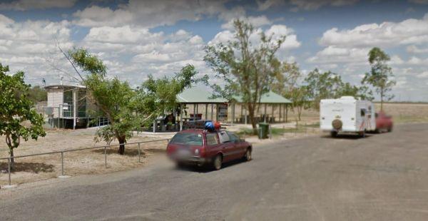
360 view - Entrance to the Maxwelton Rest Area
Maxwelton Rest Area location map
Address
Flinders Highway, Maxwelton, 4822, Queensland
Sat Nav Coordinate
-20.722963, 142.678174
Suitable for
Shared - Cars and Trucks
Road Access
Asphalt Road Surface
Parking Area
Predominantly Asphalt Surface
Elevation above Sea Level
171.9 meters
Drive through site
Yes - Some Drive through sites available
Big Rigs
Yes - there is room to maneuver
Toilets
Yes - At least one public toilet block available
Dump Point
No black water dump point
Rubbish Bins
Yes - At least one rubbish bin located here
Drinking Water
No drinking water onsite - Bring your own fresh water with you
Shade
There is limited shade available at this location
Picnic Tables
Yes - At least one Picnic Table located here
Fixed Fire places
No fixed fireplaces
Fixed BBQ's
No - BBQ facilities onsite
Pet Friendly
Yes - Dogs are Permitted Conditions Apply
Childrens Playground
No playground infrastructure onsite
Short Walks
Nothing much to see here
Fishing
No fishing spots within easy walking distance
TV Reception
Unknown if you can get a TV signal here
Mobile Phone Reception
Mobile phone coverage is available depending on your carrier
Internet Access
Yes - Uses your Mobile Phones Internet Data Plan
Unique Pageviews
2,946
Facilities Available
 ,
,  ,
, 
Camping Info