Mungallala Creek Rest Area
Location Map
360 view - Entrance to the Mungallala Creek Rest Area
Mungallala Creek Rest Area location map
Address
Warrego Highway, Mungallala, 4467, Queensland
Sat Nav Coordinate
-26.44535, 147.541289
Entrance side
Vehicles travelling Westbound
Suitable for
Caravans and Motorhomes
Road Access
Asphalt Road Surface
Parking Area
Gravel Surfaced Area
Elevation above Sea Level
431.9 meters
Drive through site
Yes - Some Drive through sites available
Big Rigs
Yes - there is room to maneuver
Power Available
No onsite mains power available
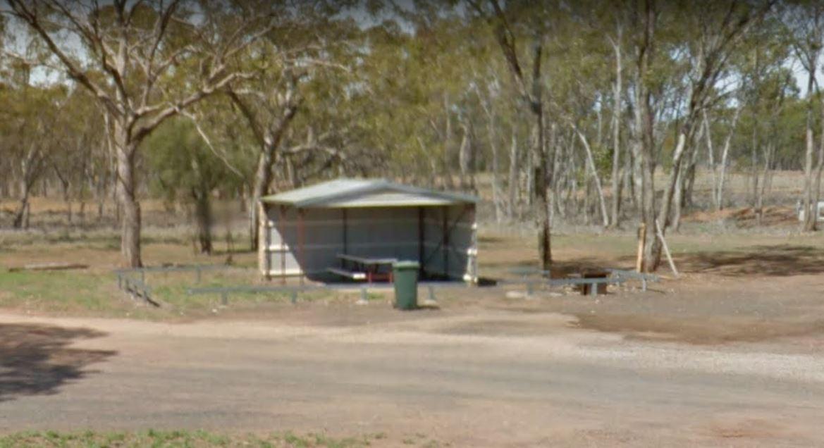
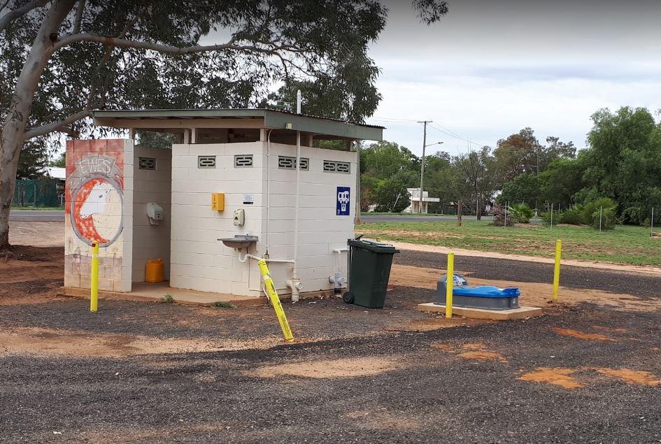
Toilets
Yes - At least one public toilet block available
Dump Point
Yes - Free dump point for black water cassettes
Rubbish Bins
Yes - At least one rubbish bin located here
Drinking Water
No drinking water onsite - Bring your own fresh water with you
Shade
There is limited shade available at this location
Picnic Tables
Yes - At least one Picnic Table located here
Fixed Fire places
No fixed fireplaces
Fixed BBQ's
No - BBQ facilities onsite
Pet Friendly
Yes - Dogs are Permitted Conditions Apply
Childrens Playground
No playground infrastructure onsite
Short Walks
Yes - Room to stretch your legs on short walks
Fishing
No fishing spots within easy walking distance
TV Reception
Yes - Your TV will pick up reception here
Mobile Phone Reception
Mobile phone coverage is available depending on your carrier
Internet Access
Yes - Uses your Mobile Phones Internet Data Plan
Unique Pageviews
3,468
Facilities Available
 ,
,  ,
,  ,
, 
Camping Info