World War II Historical Site Rest Area
The World War II Historical Site Rest Area is not too bad a place to stop for a night or two, but not a lot to see or do once you turn off the car engine. This site gets its name from being a WWII Aircraft landing strip nearby.
Location Map
360 view - Entrance to the World War II Historical Site Rest Area
World War II Historical Site Rest Area location map
Address
Barkly Highway, Gunpowder, 4825, Queensland
Sat Nav Coordinate
-20.372771, 139.263854
Entrance side
Vehicles travelling Southbound
Suitable for
Shared - Cars and Trucks
Road Access
Asphalt Road Surface
Parking Area
Gravel Surfaced Area
Elevation above Sea Level
382.0 meters
Drive through site
Yes - Some Drive through sites available
Big Rigs
Yes - there is room to maneuver
Power Available
No onsite mains power available
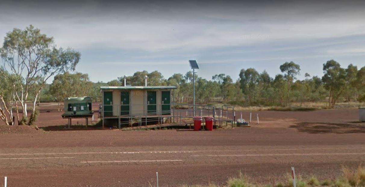
Toilets
Yes - At least one public toilet block available
Dump Point
No black water dump point
Rubbish Bins
Yes - At least one rubbish bin located here
Drinking Water
No drinking water onsite - Bring your own fresh water with you
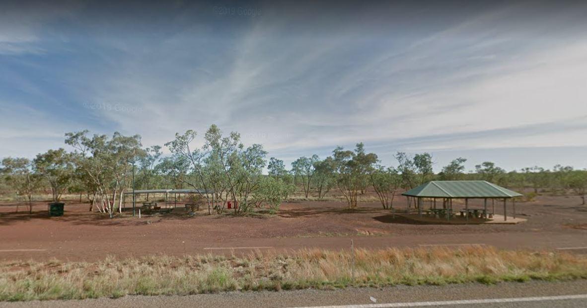
Shade
There is limited shade available at this location
Picnic Tables
Yes - At least one Picnic Table located here
Fixed Fire places
No fixed fireplaces
Fixed BBQ's
No - BBQ facilities onsite
Pet Friendly
Yes - Dogs are Permitted Conditions Apply
Childrens Playground
No playground infrastructure onsite
Short Walks
Nothing much to see here
Fishing
No fishing spots within easy walking distance
TV Reception
Yes - Your TV will pick up reception here
Mobile Phone Reception
Mobile phone coverage is available depending on your carrier
Internet Access
Yes - Uses your Mobile Phones Internet Data Plan
Unique Pageviews
3,351
Facilities Available
 ,
,  ,
, 
Camping Info