Barmah Lakes Camping Area
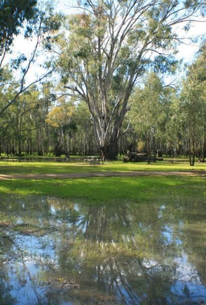
Barmah Lakes Camping Area is close to the Murray River and is great for Kayaking, Photography, Fishing, Swimming, and there is a boat ramp as well.
Location Map
Barmah Lakes Camping Area location map
Address
Sand Ridge Track, Barmah, 3639, Victoria
Sat Nav Coordinate
-35.958007, 144.958322
Suitable for
Caravans and Motorhomes
Tags
Road Access
Dry Weather Road Only
Parking Area
Gravel - Dry Weather Only
Elevation above Sea Level
103.7 meters
Drive through site
Yes - Some Drive through sites available
Big Rigs
Yes - there is room to maneuver
Power Available
No onsite mains power available
Toilets
Yes - At least one public toilet block available
Dump Point
No black water dump point
Rubbish Bins
No rubbish bins onsite - So PLEASE Take your rubbish with you when you leave
Drinking Water
Creek or River Water is within walking distance
Shade
Yes - Quite a few Shady Spots to select from
Picnic Tables
Yes - At least one Picnic Table located here
Fixed Fire places
Yes - At least one fixed fireplace onsite - Remember to bring your own supply of firewood
Fixed BBQ's
No - BBQ facilities onsite
Pet Friendly
No Dogs Permitted at any time
Childrens Playground
No playground infrastructure onsite
Short Walks
Yes - Room to stretch your legs on short walks
Fishing
Yes - Some Fishing spots within walking distance
TV Reception
Unknown if you can get a TV signal here
Mobile Phone Reception
Unknown if you can get a mobile signal here
Internet Access
Unknown if you can recieve a mobile phone Internet signal here
Unique Pageviews
5,054
Facilities Available
 ,
,  ,
,  ,
,  ,
, 
Camping Info