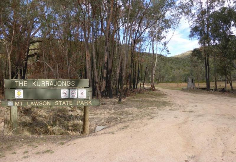
Kurrajongs Camping Area
From the Kurrajongs Camping Area, you can walk to the Mt Lawson Summit (1,041m) and generally enjoy the area.
Location Map
360 view - Entrance to the Kurrajongs Camping Area
Kurrajongs Camping Area location map
Address
4951-5901 Murray River Road, Thologolong, 3691, Victoria
Sat Nav Coordinate
-35.95575,147.419767
Entrance side
Vehicles travelling Eastbound
Suitable for
Caravans and Motorhomes
Tags
Road Access
Unsealed Gravel Road Surface
Parking Area
Gravel Surfaced Area
Elevation above Sea Level
209.4 meters
Drive through site
Yes - Some Drive through sites available
Big Rigs
Yes - there is room to maneuver
Power Available
No onsite mains power available
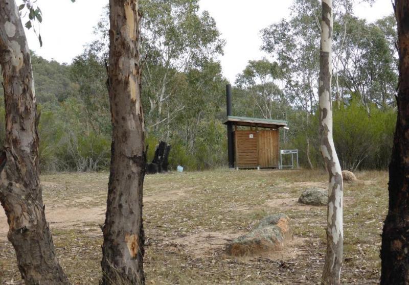
Toilets
Yes - At least one public toilet block available
Dump Point
Yes - dump point for Patrons Only
Drinking Water
No drinking water onsite - Bring your own fresh water with you
Shade
Yes - Quite a few Shady Spots to select from
Picnic Tables
Yes - At least one Picnic Table located here
Fixed Fire places
No fixed fireplaces
Fixed BBQ's
No - BBQ facilities onsite
Pet Friendly
No Dogs Permitted at any time
Childrens Playground
No playground infrastructure onsite
Short Walks
Yes - Room to stretch your legs on short walks
Fishing
No fishing spots within easy walking distance
TV Reception
Unknown if you can get a TV signal here
Mobile Phone Reception
Unknown if you can get a mobile signal here
Internet Access
Unknown if you can recieve a mobile phone Internet signal here
Unique Pageviews
3,383
Facilities Available

Camping Info