Waterfalls Picnic and Campground
The Waterfalls Picnic and Campground has quite a few hiking tracks to choose from, including an 18 km Pyrenees Endurance Walk for the more energetic amongst us.
Location Map
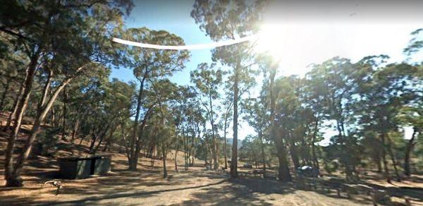
360 view - Entrance to the Waterfalls Picnic and Campground
Waterfalls Picnic and Campground location map
Address
Ebling Track, Percydale, 3467, Victoria
Sat Nav Coordinate
-37.098635,143.367166
Suitable for
Caravans and Motorhomes
Road Access
Unsealed Gravel Road Surface
Parking Area
Gravel Surfaced Area
Elevation above Sea Level
396.2 meters
Drive through site
Yes - Some Drive through sites available
Big Rigs
Yes - there is room to maneuver
Power Available
No onsite mains power available
Toilets
Yes - At least one public toilet block available
Wheelchair Accessible Toilets
Yes - public toilets with wheelchair access available
Dump Point
No black water dump point
Rubbish Bins
No rubbish bins onsite - So PLEASE Take your rubbish with you when you leave
Drinking Water
No drinking water onsite - Bring your own fresh water with you
Shade
Yes - Quite a few Shady Spots to select from
Picnic Tables
Yes - At least one Picnic Table located here
Fixed Fire places
Yes - At least one fixed fireplace onsite - Remember to bring your own supply of firewood
Fixed BBQ's
Yes - At least one BBQ facility is available
Pet Friendly
Yes - Dogs are Permitted Conditions Apply
Childrens Playground
No playground infrastructure onsite
Short Walks
Yes - Room to stretch your legs on short walks
Fishing
No fishing spots within easy walking distance
TV Reception
Unknown if you can get a TV signal here
Mobile Phone Reception
Unknown if you can get a mobile signal here
Internet Access
Unknown if you can recieve a mobile phone Internet signal here
Unique Pageviews
2,950
Facilities Available
 ,
,  ,
,  ,
, 
Camping Info