Directory: Recently Added Listings
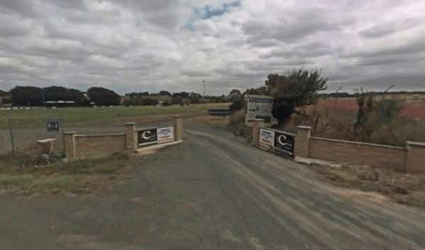
Rupanyup Memorial Park, located at 89 Wimmera Highway in Rupanyup, Victoria 3388, offers a convenient and affordable stop for travellers, particularly those exploring the renowned Silo Art Trail. Situated beside a tranquil billabong, the park provides bot ...
Read More...
 ,
,  ,
,  ,
,  ,
,  ,
,  ,
,  ,
, 
Queenscliff Recreation Reserve
Queenscliff Recreation Reserve, part of the Queenscliffe Tourist Parks, offers a coastal camping experience in the charming town of Queenscliff, Victoria. Situated a stone's throw from the beach and bay, the reserve provides a convenient base for explorin ...
Read More...
,  ,
,  , ,
, ,  , , , ,
Princetown Recreation Reserve
Princetown Recreation Reserve is a popular campground located on the Great Ocean Road in Victoria, approximately 6 kilometres east of the iconic Twelve Apostles. Situated adjacent to the Gellibrand River and close to the Princetown Wetlands and Princetown ...
Read More...
, , , ,  , ,
, ,
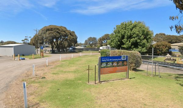
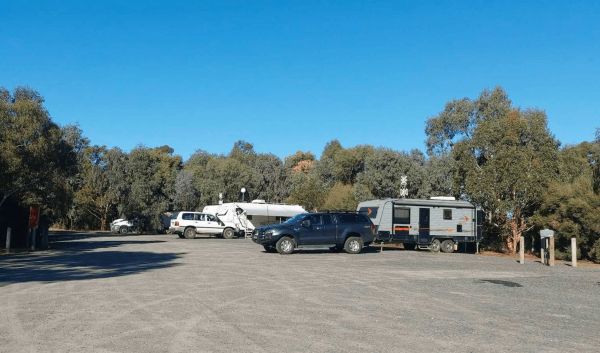
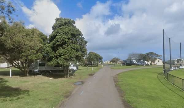
Henty Park in Portland, Victoria, is a notable recreational area that includes a designated RV camping area. It is located near the town centre and the foreshore, making it a convenient spot for visitors to explore Portland. The park itself features sport ...
Read More...
, , , ,
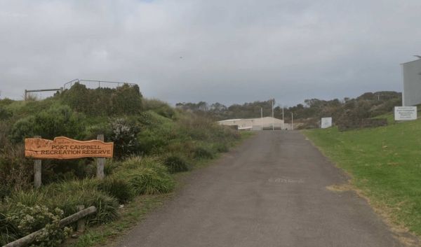
Port Campbell Recreation Reserve Camp Ground
Port Campbell Recreation Reserve, located in the township of Port Campbell on Victoria's iconic Great Ocean Road, offers a popular camping option for visitors exploring the stunning coastline. Situated in a natural bush setting with views of the Campbell ...
Read More...
, ,
Port Albert Racecourse & Recreation Reserve
Port Albert Racecourse Recreation Reserve, located in Langsborough near the historic town of Port Albert in Victoria, offers camping facilities.
Facilities: The reserve and the nearby Port Albert area provide some essential facilities for campers:
To ...
Read More...
, ,
Poowong Recreation Reserve in Victoria offers a budget-friendly camping option for travellers, particularly those with self-contained vehicles.
Powered sites are available: payment to be made at the local pub in Poowong.
Facilities: The reserve provides ...
Read More...
, , , ,
Piangil Memorial Park, also known as Piangil Recreation Ground and Hall, offers camping and caravan parking with facilities available for visitors. Situated in Piangil, Victoria, the park provides a convenient stop for those exploring the Murray River reg ...
Read More...
, , ,
The Panmure Recreation Reserve, often referred to as Panmure Campground or Panmure Free Camp, is a public reserve located just off the Princes Highway at Panmure, Victoria. It serves as a free camping area and a local recreational spot, offering a conveni ...
Read More...
, , , ,
The Oxley Recreation Reserve, located at 300-312 Oxley-Meadow Creek Road, Oxley VIC 3678, is a unique and expansive reserve situated in Victoria's picturesque High Country. Covering 47 hectares, the reserve features a blend of bushland and cleared areas a ...
Read More...
, , , , , , ,  ,
,
The Numurkah Showgrounds and Recreation Reserve, located on Tunnock Road in Numurkah, Victoria, is a multi-purpose community facility that serves as the town's showgrounds, a recreational hub, and offers camping facilities for visitors. Situated in the at ...
Read More...
, , , , , ,
Newstead Racecourse and Recreation Reserve is a historic and spacious reserve located in the town of Newstead, Victoria, situated on the banks of the Loddon River in the heart of the Goldfields region. Once renowned as the longest racecourse in Australia, ...
Read More...
, , , , , , ,
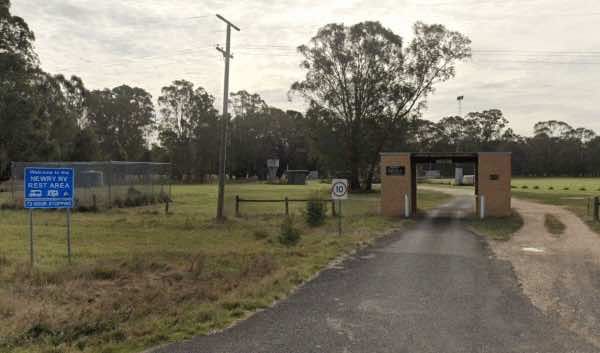
Newry Recreation Reserve is a designated free rest area located at 838 Three Chain Road in Newry, Victoria, adjacent to the Newry Golf Club. It offers a convenient and low-cost overnight stop for self-contained travellers in the Gippsland region.
Descrip ...
Read More...
, , ,
Newbridge Recreation Reserve is a welcoming community space and low-cost campground situated on the banks of the Loddon River in the small town of Newbridge, Victoria. It serves as a popular spot for both locals and visitors seeking a relaxed riverside ex ...
Read More...
, , ,  , , , ,
  , , ,
, , ,
Nariel Creek Recreation Reserve
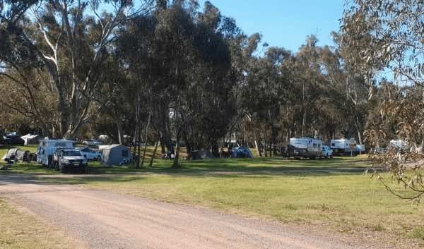
Nariel Creek Recreation Reserve is a spacious and picturesque camping area situated on the banks of Nariel Creek in the Nariel Valley, Victoria. Located approximately 12 kilometres south of Corryong along the Benambra-Corryong Road, it's known for its nat ...
Read More...
, , , , ,

Nambrok Recreation Reserve, which also includes the Nambrok Public Hall, is a local community facility in Nambrok, Victoria, that offers recreational spaces and camping facilities for travellers. Located within the Wellington Shire, it provides a convenie ...
Read More...
, ,
Myrtleford Recreation Reserve
Myrtleford Recreation Reserve, also known as the Myrtleford Showgrounds, is a prominent community hub in Myrtleford, Victoria, offering extensive sporting facilities and providing camping options for visitors. Located within the town, it serves as a conve ...
Read More...
, , , , , , ,
Muckatah Recreation Reserve is a 40-acre public reserve located in Muckatah, Victoria, offering a spacious and open area for recreation and camping. Situated in the Moira Shire, it provides a rural escape with basic facilities for travellers.
The reserve ...
Read More...
, , ,
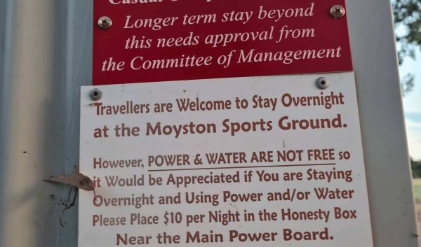
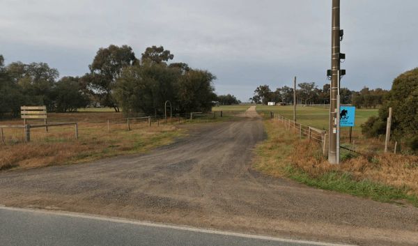
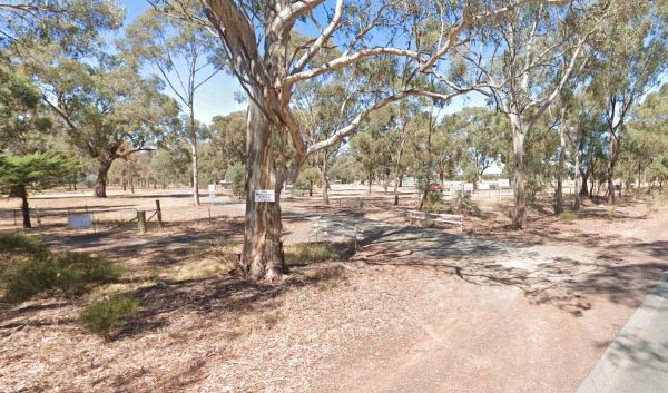
Moyston Sports Ground offers a convenient and affordable camping option located in the township of Moyston, Victoria, known as the birthplace of Australian Rules Football. It provides a relaxed base for exploring the nearby Grampians National Park and the ...
Read More...
, , ,
Moora Racecourse & Recreation Reserve is a spacious 40-acre public reserve located approximately 8 km from the town of Rushworth in Victoria. Managed by a local committee, it functions as both a racecourse and a recreation area, and is also a register ...
Read More...
, ,